
Sustainable urban development is increasingly about being able to collaborate and jointly build a sustainable city. In urban development, working with the city’s green structures and concepts such as nature-based solutions, ecosystem services and green infrastructure is a priority in Sweden and within the EU.
At the national level, municipalities now have the task of integrating work with ecosystem services more broadly and more deeply. According to the Government’s letter Strategy for living cities (Strategi för Levande städer – politik för en hållbar stadsutveckling), municipalities shall over the next five-year period have gained access to developed methods for utilising and integrating urban greenery and ecosystem services in planning, construction and administration in cities and urban areas.
One challenge is to reach out with knowledge and understanding from research and new methods. This needs to be shared by many different actors involved in the urban development process – such as citizens, ecologists, architects, landscape architects, development engineers, municipal planners and construction companies. The web service Stadstrad.se is a link between these actors and constitutes a common knowledge base that is constantly updated, growing and spreading knowledge about the values and functions of trees in the city.
There are many good reasons to protect trees in the urban environment, as they contribute in many different ways to our well-being and a sustainable society. They provide better mental health (reduces stress, anxiety and depression), cleaner air, more pleasant temperatures, lower stormwater flows and more songbirds. With new research, the list grows and the importance of trees for housing becomes increasingly important in planning.
Stadstrad.se is available to everyone for exploring trees, and contributes to the knowledge about trees in the neighbourhood. From the start, the idea with Stadsträd has been to both provide a tool to bridge the gap between experts and the general public and to communicate the value of urban greenery. We want to spread the tool so that many people can contribute to building knowledge around the city’s trees.
More than parks
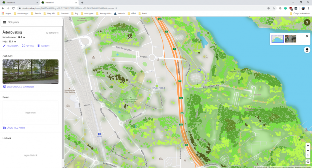
To understand the importance of trees in the city, we need to get an overview of all the city’s trees – not just trees in parks, or along streets. Only then can we see how trees contribute to ecosystem services and how they are part of the green infrastructure. Stadstrad.se is a tool for visualising the city’s trees. The service was developed during 2018–2019 with funding from the Swedish Environmental Protection Agency’s programme “Urban Innovations” and is now run by Geografiska Informationsbyrån and Calluna AB. It collects comprehensive and updated geodata about the city’s trees – a combination of trees mapped from lidar scanning and data collection in the field (both by professionals and through crowdsourcing). The app includes all the city’s trees mapped with lidar data, but other sources, such as tree surveys and inventories, can be added later.
While this type application is not unprecedented internationally, in Sweden it is the only one of its kind. One of the most famous examples elsewhere, recognised as an international world leader by Viable Cities, visualises information on the 680,000 trees of New York City and showcases their ecological benefits.
Treepedia and Registree are examples of new methods for mapping “street trees” through image analysis of information from Google street view. These methods, however, only capture a subset of the city’s trees and do not place the trees in the context of green infrastructure.
Trees contribute to better health
Examples of how trees and greenery affect human health are given in the report “Human health in growing cities” where Mare Lõhmus writes:
“The effect of natural environments on public health in cities has been a very fast growing area in environmental medical research over the past decade. Consequently, there is now a strong scientific basis that shows that even short-term exposure to natural environments can have a number of positive effects on the population’s health and well-being. Many international studies, including a report by the World Health Organization (WHO), suggest that increased exposure to urban greenery leads to reduced mortality, improved mental health, increased physical activity and reduced risk of underweight births.”
The report discusses nine possible mechanisms for how urban greenery contributes to better health:
- Increased relaxation and reduced stress
- Improved social capital
- Better immune system
- Increased physical activity
- Reduced exposure to noise
- Reduced exposure to air pollutants
- Reduced exposure to urban heat islands
- Optimised exposure to sunlight and improved sleep
- Increased environmentally conscious behaviour
Read more about trees and health in the report or summary (In Swedish).
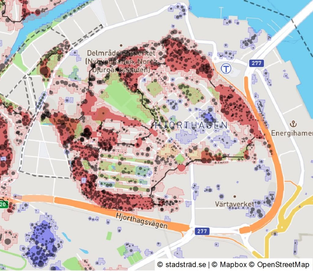
Analysing the quality of green infrastructure by using the habitat network tool
Green infrastructure is a concept that enables longer-term planning, with the aim of creating sustainable landscapes with ecologically functional networks of habitats. It is also crucial for successful sustainable community planning.
The habitat network tool in the stadstrad.se application helps us understand how urban trees form green infrastructure and, even more importantly, how it meets the requirements of certain forest birds species. It takes into account various landscape parameters such as species requirements for habitat and distribution. Additionally the tool considers the species’ specific preferences, such as some species’ reluctance for open areas, dense urban areas or busy roads.
The dispersion analysis for forest birds is based on each individual tree found in stadstrad.se, adding a buffer of a maximum of 40 metres. When the trees are close enough to each other, continuous tree areas are formed. The distance calculations use friction grids, which means that barrier effects are weighed in the analysis. The buffer will be different, depending on how hospitable or inhospitable the ground is for the movement of forest birds.
The analysis identifies trees that stand in a forest core, trees that stand on the edge, and trees that stand solitary, in smaller groves or paths. Forest core is defined in the analysis as the inner part of a forest area, i.e. where the trees are not at the edge of the forest. Forest edges are defined as a zone of 20 m around a continuous forest area.
Through the analysis, we gain knowledge about ecological issues in the landscape. For example, we can detect which treelines are the most vital for forest bird mobility and which forest areas can act as habitats for birds that are sensitive to fragmentation and edge effects.
Estimating the value of ecosystem services
i-Tree is an international initiative for the analysis of urban trees. The US Forest Service has developed several methods for estimating the ecosystem services of trees, e.g. carbon sequestration, hydrological effects, air purification and health effects. However, this continues to be a field of ongoing research. i-Tree is a tool for calculations, aimed at experts, but it does not visualise the city’s trees and the value of their ecosystem services.Many Swedish municipalities have started using the i-Tree application for tree management purposes, and a major conference was held in Malmö with large participation from municipalities.
Entering and getting calculations from i-Tree is currently not user-friendly, but Stadsträd.se facilitates that process.
Lidar mapping of trees
The Stadsträd application is based on the comprehensive mapping of trees in urban areas and forests close to the city. Since 2019, altogether sixteen municipalities, such as Östersund, Sundsvall, Helsingborg and Ängleholm, have ordered the mapping of tree points based on lidar data within one or more urban areas to be published in stadstrad.se.
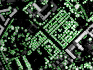
This technique produces tree points based on object elevation rasters computed from lidar data of varying origin. The Swedish Forest Agency’s forest elevation grid with 2-metre resolution produced from the National Land Survey’s national scan, “Laserdata Skog”, was used in 2019. The advantage of using this national dataset is that it reduces the costs of production, and the results will be homogeneous and comparable between different areas. The disadvantage is that data in some areas has become obsolete and the resolution is not good enough to separate all tree crowns from each other.The principle for tree mapping is based on finding local maxima in the elevation model with delineation of tree crowns around these maxima. Further processing is done in several steps, e.g. trees are flagged near buildings, and smaller objects and trees are cleared away, using various methods.
The result is exported as a point layer, where each point has the height and crown diameter as attributes. Additionally land cover class from the national ground cover data (Nationella Marktäckedata CadasterENV Sweden), covering the whole country, is added as a first indication of forest type.
Using and contributing to the Stadsträd application
Everyone can participate and contribute to the application by adding information about the trees in their immediate area with a basic license, which is free. This is possible even if the area has not been mapped before.
Register with an e-mail address at www.stadstrad.se. Then bring your cell phone out for a ‘tree walk’, or do as several schools have already done: incorporate the application into the teaching process. Read more about Stadsträd, in Swedish, at info.stadstrad.se.