
On every continent, people are experiencing changes in their climate. At the same time, most of the world’s population now lives in cities, so it is essential to plan cities that are climate-smart. Stockholm is no exception. Scientists forecast that from 2030 onwards, the city’s neighbour, the Baltic Sea, is going to start rising – by up to 3 metres. At the same time, Stockholm is growing. By 2030, the population is estimated at 1.3 million and the city’s boroughs have ambitious building plans to create thousands of new homes.
Stockholm’s city planners are busy, to say the least. Planners have to create visions for new neighbourhoods that align with national goals for creating a resilient capital with low carbon emissions and global objectives such as the Sustainable Development Goals. There are also the specific targets set out by politicians to ensure that Stockholm is a safe city, with services that every citizen can access.
Before addressing the needs of present-day and future citizens, a central challenge for planners is to understand who the average citizen is. The demographics of Stockholm vary from borough to borough, as does the level of education and unemployment. Faced with high demands and expectations both at the local and national levels, as well as a sea of question marks, Stockholm’s city planners have their work cut out for them.
Studying XR as a tool for integrated planning in the context of Stockholm
The timing for Augmented Urbans’ case study of Stockholm’s planning reality was ideal because the project’s aim was to develop a virtual reality or augmented reality prototype to support planning processes that integrate both people and nature. The thinking behind an integrated planning process is that the resilience and sustainability of the city are enhanced because a more holistic approach factors in the role that nature can play in mitigating the impacts of a changing climate. How can a project begin to tackle a large and complex system like a city? Augmented Urbans zooms in on two key elements: 1) engaging citizens in planning processes, and 2) visualising the flows of ecosystem services.
Identifying what planners need
A first step in the process was to contact city planners. Easier said than done! Planners are busy people and it took persistence and time, but once contact was made the interviews with them helped to identify what the planning challenges are in each borough of Stockholm, what tools are currently used, the level of citizen engagement, what the appetite is for VR or AR. Responses were positive – planners recognise that they need various ways to engage citizens. Furthermore, some planners had been using visual and digital tools like touch screens to help translate their plans to citizens. Virtual reality and augmented reality struck them as a possible way of attracting the attention of young people who are a particularly difficult audience to engage.
What location
Following conversations with several planners in different boroughs of Stockholm, the Augmented Urban team began discussing possible locations for the prototype and where it should be designed for a specific place or whether it should be a generalised vision that could apply to multiple sites in the city. At first, the pros and cons were equally convincing. The advantage of developing a tool with more general application was that it could be tested by planners in different boroughs of the city. The advantage of choosing a specific location was that the audience would be able to situate themselves and the prototype itself could address the particular social and ecological challenges relevant to one place.
Who has the expertise?
Next, we set about searching for a developer. Stockholm is a hub for game developers who often use VR. But when we threw in the need for knowledge and expertise about climate change, ecosystem services and how social ecological systems interact with each other, there was less choice. Settling on the right developer was also a process of careful thinking about the priorities of the Augmented Urbans case in Stockholm that drew on experiences from the partner cities in Augmented Urbans and insights from advisory board members. Should the prototype be virtual reality or augmented reality? A crucial decision hinged on whether the prototype was going to invite feedback from its audience or whether the emphasis was more educational – to raise awareness about the interactions of ecosystem services and the impacts of design decisions on those flows. For example, does asphalt support or hinder pollination?
Developing the prototype
The winning pitch set out a vision for a virtual reality application rather than an augmented reality prototype. Although the developers were eager to learn more about the impacts of climate change in Stockholm, their knowledge about ecosystem services was limited and we agreed on a working plan that included an exchange of special knowledge: sustainability and resilience science for the latest developments in gaming technology.
Early on in our brainstorming workshops, we understood that we would get much further in our aims of raising awareness and visualising the outcomes of design decisions on ecosystem flows and systems if we located the VR experience in a specific location in Stockholm. Previous experiences with narratives in both the development team and the AU team helped to quickly make a decision to apply the same structure as to developing the app as to telling a good story. To create an engaging VR experience would require taking the audience on a journey and telling them a good story. And a common ingredient in storytelling is choosing a location for the action to take place.
Multiple knowledge types
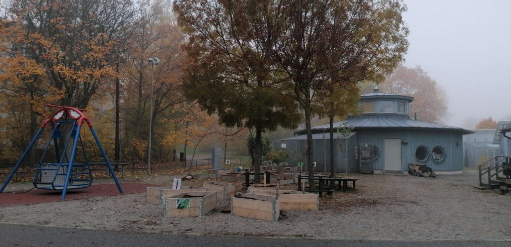
In conversations with one planner in the borough of Skärholmen, a compelling list of challenges for both nature and residents in that area came to light. It is an area where a majority of residents were born outside Sweden, there is a high percentage of young people and high unemployment. At the same time, the area has high-quality green spaces but local planners have little knowledge about who uses the green spaces, or when or for what purpose. We consulted the planner and asked if there were any plans currently in progress to develop areas in the borough. The planner suggested a location that was earmarked for development in the future – a playground. Choosing this location for our app would give us two advantages. It was a specific location where we could situate ourselves and the user, where we could begin and end a story and, where we would have the freedom to create our own vision because there was no development plan or blueprint in existence.
Challenges and learnings
With a common aim and vision laid out, the next challenge was to create the content and build the infrastructure of the app. These included its design and look and feel, how the user would interact and crucially, how to translate complex science into an audiovisual experience. Finding a common language, including how to refer to ecosystem services was important in facilitating our communications and decisions. The learning and exchange of knowledge between planners, the AU team and the developers involved a process with several stages and steps:
Selecting the relevant ecosystem services for the location, we had picked, for example, water absorption and air temperature, based on the climate challenges in Stockholm – predictions of increased rainfall and warmer temperatures over the next ten years – as well as some more general urban challenges such as pollination and air quality.
Bridging the gap between research and technology – finding a common language and creating a new one. We overcame this through good communication – weekly meetings with the developers in which we asked each other questions to better understand one another’s processes. A useful exercise was to write out a narrative for the VR experience – when you put on the headset, what happens? What do you see? What do you hear? What can you choose to do? What are the instructions you get? What is the information you receive?
There are few such technologies, so finding reference points was difficult – pioneering work. On a personal note, I found that my years of making documentaries helped a lot in terms of previous knowledge about creating narratives from complex science and translating scientific papers and cutting-edge research into sound, image, emotion, story. (VM)
How did the planner respond to the prototype
Meeting in person to test the prototype was not possible due to Covid-19 risks and restrictions. Nevertheless, we presented an online version to planners in Zoom and even though the full 3D, immersive experience was replaced by a web-based version, planners responded enthusiastically to the prototype. Firstly, some planners commented on the novelty of positioning themselves in a real place where they could use their mouse to look around in space. A planner who works with youth groups suggested using icons and functionality that is commonly used on Google maps to help that audience quickly familiarise themselves with the navigation options in the prototype as a way of making the tool intuitive.
Conversations with planners flowed during the testing sessions and the discussions revealed more details about planning processes – a top priority in Stockholm is ensuring that access to and around locations is universal – for example for wheelchair users and parents pushing prams. This was important to understand in situations where there are clashes between accessibility and maximising ecosystem services – a meadow of wildflowers that covers a large space is not accessible in the same way as an asphalt path.
A starting point for conversation and engagement
As an experience, whether 2D or 3D, the prototype is an audiovisual tool that can be used to fulfill the two principal aims that the Augmented Urbans Stockholm team identified: 1) engaging citizens in planning processes, and 2) visualising the flows of ecosystem services.
The process of developing the prototype was an opportunity in itself to engage with planners and technology developers and, once the Covid restrictions are eased, it will present opportunities to talk with citizens. As a concrete and tangible object, the audience could react and respond to the prototype and easily express their views and opinions. They found it easy to make helpful suggestions about improvements for the next version of the prototype. In this way, the prototype has the potential to be an ongoing work-in-progress, a starting point for conversations and thinking together about an integrated urban planning process.